The problem
Agriculture accounts for around 70% of global freshwater withdrawals, yet much irrigation still follows fixed schedules, historical averages or indirect indicators rather than what the crop is experiencing on the day (EIT Food, 2025). Over-irrigation wastes water and pumping energy. Under-irrigation during a heatwave can push a crop past the point of recovery.
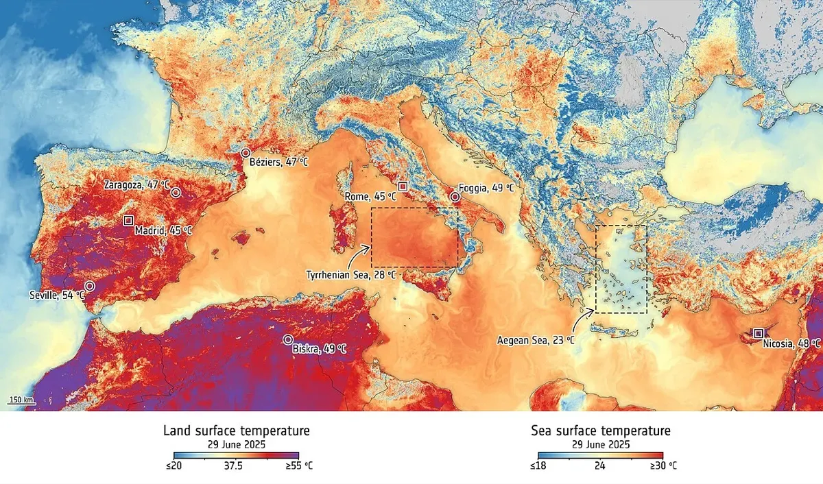
Optical satellites show when a field turns brown, which is too late. Temperature is the earlier signal, but Europe’s public thermal data are coarse. Sentinel-3 measures land surface temperature at around 1 km, far wider than a typical farm plot. The Copernicus Land Surface Temperature Monitoring mission (LSTM), designed to monitor evapotranspiration at field scale, is listed for launch in 2029 or later (WMO OSCAR). That leaves a gap of several years.
The product
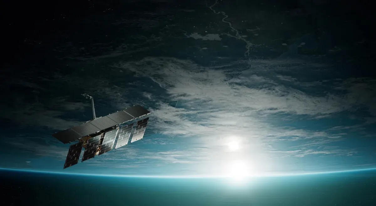
constellr tested its thermal technology on the International Space Station in 2022, capturing more than 10 million images, before building its own satellites (Business Wire, 14 January 2025). SkyBee-1 launched on 14 January 2025 on SpaceX’s Transporter-12 rideshare from Vandenberg, integrated by Exolaunch, with development support from ESA’s InCubed programme (Copernicus Rapid Response Desk; ESA Φ-lab).
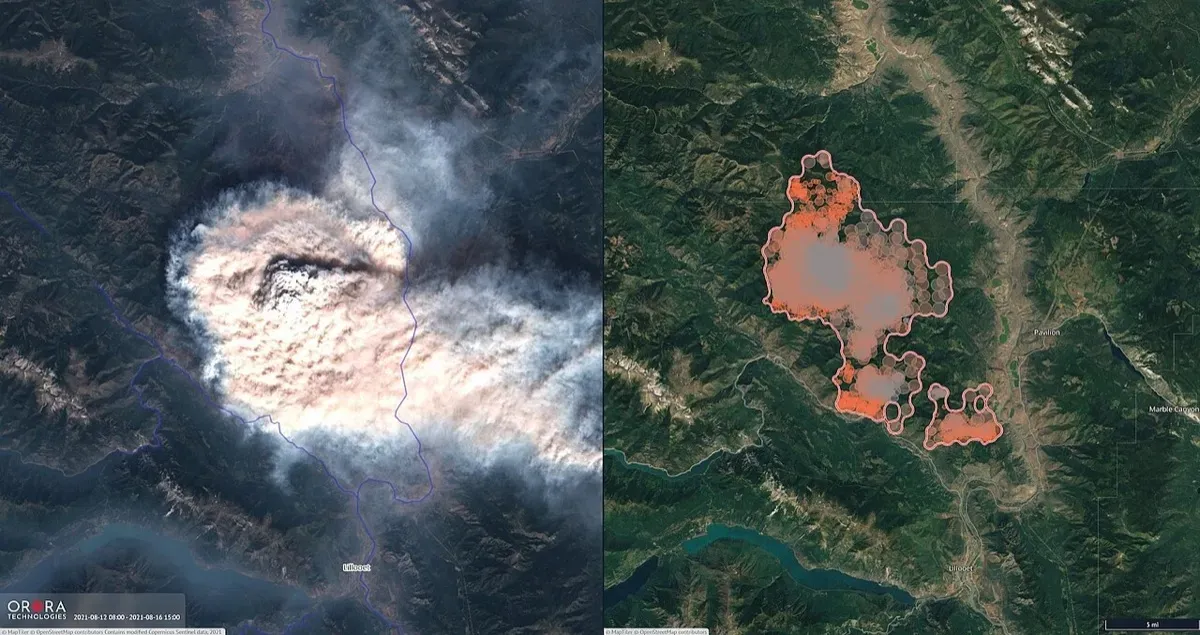
The same rocket also carried OroraTech’s FOREST-3 wildfire satellite, Pixxel’s first three Firefly hyperspectral satellites and Planet’s Pelican-2, a snapshot of how quickly commercial Earth observation is growing.
SkyBee-2 followed on 23 June 2025, co-financed under an ESA ScaleUP INVEST contract signed in May 2024. constellr has been an emerging Copernicus Contributing Mission since 2023, working with ESA on calibration and validation so its data can feed Copernicus services.
How it works
Every surface emits thermal infrared radiation in proportion to its temperature. SkyBee’s four-band thermal camera, cooled by a cryocooler, measures that radiation, while an 11-band visible and near-infrared camera supplies the context needed to separate the surface from the atmosphere and to orthorectify the image (ESA Earth Online). The output is land surface temperature at a native 30 m resolution with thermal accuracy better than 2 K. constellr quotes 2.0 °C absolute accuracy and 0.1 °C sensitivity.
The two satellites cross the equator at different local times: SkyBee-1 at 10:30 and 22:30, SkyBee-2 at 13:30 and 01:30 (ESA Earth Online, mission description). Day and night pairs matter. A field that stays hot after dark, or heats faster than its neighbours at midday, is short of water.
The physics behind the stress signal is simple. A well-watered leaf transpires, and evaporating water carries heat away, just as sweat cools skin. When soil moisture runs short, plants close their stomata to conserve water, transpiration falls and the canopy warms relative to the air. Thermal sensors therefore detect a change in plant behaviour, not a change in colour, which is why the signal arrives earlier than in optical imagery. The same measurements show which streets and rooftops store the most heat in a city, where a pipeline leak is cooling the ground, or how lake and river temperatures shift in a heatwave.
constellr’s HeatR platform turns these measurements into crop water stress signals, so farmers and advisers can see stress building days or weeks before it is visible, and match irrigation to actual need.
Timeline
| Date | Milestone |
|---|---|
| 2020 | constellr founded in Freiburg |
| 2022 | Thermal sensor tested on the International Space Station |
| 2023 | Onboarded as an emerging Copernicus Contributing Mission |
| May 2024 | ESA ScaleUP INVEST contract to co-finance the second satellite |
| 14 Jan 2025 | SkyBee-1 launched on Transporter-12 |
| 23 Jun 2025 | SkyBee-2 launched |
| 10 Feb 2026 | €37 million Series A |
| H2 2026 (planned) | SkyBee-3 launch |
Impact and numbers
- Water savings: up to 40% lower water use where the technology is applied, according to EIT Food, citing investor Lakestar.
- ISS heritage: more than 10 million images captured during the 2022 space station test, which de-risked the sensor before the first free-flying satellite.
- Coverage: 30 m thermal data with about 1.5-day revisit by day and night from two satellites; revisit will shorten as the constellation grows towards up to 30 satellites by 2030.
- Investment: the February 2026 round was led by Alpine Space Ventures and Lakestar (constellr, 10 February 2026).
Honest caveats. constellr’s emphasis has shifted sharply towards defence. Its Series A announcement is about “defence-grade thermal intelligence” for military and security agencies, with an example of monitoring a Russian submarine base, and agriculture is not mentioned. Green buyers should check that civil and climate products remain a priority. Thermal data also have physical limits: clouds block thermal infrared, so stress signals can go missing during long overcast spells, and 30 m pixels still blur small or mixed plots. The headline water savings come from the company and its investors rather than independent trials.
What’s next
SkyBee-3 is planned for the second half of 2026, and the Series A funds next-generation platforms with sub-5 m resolution. In 2029 or later, Copernicus LSTM should provide free public thermal data at similar resolution. constellr’s opportunity is to offer higher revisit and analytics on top of that public baseline, as commercial optical companies already do alongside Sentinel-2.
Why it matters for Europe / green buyers
Southern Europe’s farmers face more frequent drought and heat, and water authorities are under pressure to cut abstraction. constellr is one of very few European companies already flying its own high-resolution thermal infrared satellites, which keeps a sensitive data stream under European control. For agribusinesses, irrigation districts, food companies with water targets in their supply chains, and city planners mapping urban heat, SkyBee data offer an early warning that optical imagery cannot. Beyond Europe, the same need is acute in India, North Africa and the Middle East, where groundwater is being pumped faster than it recharges and electricity for irrigation pumps is often subsidised, so wasted water is hard to see in a bill. Field-scale thermal data give regulators and farmers a shared, independent picture of where water is really going. Buyers should ask for field validation in their own crops and climate, and check how data rights work alongside the company’s growing security business.
Sources & image credits
- Business Wire, “constellr Launches First Satellite, Ushering in a New Era of Global Thermal Monitoring”, 14 January 2025: https://www.businesswire.com/news/home/20250114003527/en/constellr-Launches-First-Satellite-Ushering-in-a-New-Era-of-Global-Thermal-Monitoring
- Copernicus Rapid Response Desk, “constellr’s SkyBee-1 satellite launched into orbit”, January 2025: https://www.rapidresponse.copernicus.eu/constellrs-skybee-1-satellite-launched-into-orbit/
- ESA Φ-lab, “HiVE’s Sky-Bee-1”: https://philab.esa.int/event/hives-sky-bee-1/
- ESA Earth Online, “constellr” mission page: https://earth.esa.int/eogateway/missions/constellr
- ESA Earth Online, “constellr Overview”: https://earth.esa.int/eogateway/missions/constellr/description
- EIT Food, “Constellr’s solution from outer space: satellite data help farmers manage water”: https://www.eitfood.eu/impact-stories/a-solution-from-outer-space-constellrs-satellite-data-help-farmers-manage-water
- constellr, “constellr Secures €37 Million Series A Funding to Deliver Defence Grade Thermal Intelligence”, 10 February 2026: https://www.constellr.com/article/constellr-secures-eu37-million-series-a-funding-to-deliver-defence-grade-thermal-intelligence
- WMO OSCAR, “Satellite: LSTM-A” (Copernicus Land Surface Temperature Monitoring): https://space.oscar.wmo.int/satellites/view/lstm_a
Images:
- “Southern Europe’s land and sea sizzles” by the European Space Agency, contains modified Copernicus Sentinel data (2025), licensed CC BY-SA 3.0 IGO (https://creativecommons.org/licenses/by-sa/3.0/igo/), via Wikimedia Commons: https://commons.wikimedia.org/wiki/File:Southern_Europe%E2%80%99s_land_and_sea_sizzles_ESA510680.jpg